


Experiencing historic towns from the River Severn
With unpowered river leisure traffic increasing, the age of the aquatic tourist may be about to dawn for our historic river towns on the River Severn and elsewhere.

|
| An archaeological tour of the Severn loop around Shrewsbury (Photo: Drummond Outdoor). |
The number of inland pre-industrial towns that are not sited on a major river, or at least a locally significant watercourse, is vanishingly small. The reasons are almost universal: rivers formed barriers and effective natural defensive features, but equally could be, and were, used as communication arteries, both by boats on the actual watercourses and by road traffic following routes along the valleys. Recent archaeological research has emphasised that all but the very smallest watercourses could be used by boat traffic, often for stages of longer routes in conjunction with the Roman and later road system.
As a consequence, the travellers’ experience of many towns would often in past centuries have been based on a waterborne approach, and it is arguable that this particular urban ‘visitor experience’ is not one that is now often shared. Catching sight of distant spires after a long journey, the end destination finally in sight but still very distant, is unlikely to have the same meaning to a motorist as it does to someone on foot or in a boat propelled by muscle power, or facing an adverse wind. Arrival too would be measurably different, the impact of tall buildings enhanced by the simple height difference between the watercourse and the townscape overlooking and dominating it. As Gordon Cullen would have put it, one is below-datum, looking up at the town as if it were set on a plinth.
At the water’s edge too, the boat-travellers’ lower perspective accords much more emphasis to features that allow access to and from the water. For the land-traveller, quays and quayside steps have little importance other than for a better, more immediate, but still essentially passive view out, over the water. But for the boat traveller, they are of supreme importance as offering potential routes off the water into the interior, for exploration, re-supply, business or relaxation. In short, towns look and feel different from the water, and when accessed from the water.
While it is routine for river towns to boast of and capitalise on the presence of their river, it is rarer for them to actively encourage its use by visitors, or even locals, except perhaps by a small number of licenced commercial tour operators. On the Severn the waterborne urban visitor experience is substantially different from town to town. Shrewsbury, on the middle-upper Severn, is the most rewarding to visit in this way as the horseshoe-shaped loop wrapped around the medieval town offers an unusually long river frontage within or adjacent to the historic core – about three kilometres – encompassing many different kinds of historic townscape, built up and open space. For this reason, the motor-vessel Sabrina has been offering trips, with commentary, to visitors for many years. The writer (in association with a local canoe-hire company) has been running well-supported canoe-based archaeological tours for a similar length of time.
Still, individuals’ ad hoc access to the river in unpowered craft is, if not actively discouraged, certainly not promoted. With the exception of a recent canoe-hire business located next to a slipway in the Quarry, Shrewsbury’s principal public park, individual access to the water is not easy. Upstream access is usually made via a slipway on private ground, near but not part of a public car park. Sole downstream access is via a swimming-pool type ladder bolted to the towpath, reassuringly placed immediately above Castlefields Weir.
The river frontages of the historic towns further downstream are all far shorter. The Severn is essential to the look, form and character of Bridgnorth, Bewdley and Worcester, as any number of postcards, guide-books and magazine features will illustrate. But the actual experience of small-craft boating in those places, while enjoyable and enlightening, is over in a flash. All are best accessed via town-edge riverside car parks; Bridgnorth has a Severn frontage of just under a kilometre within the historic built-up area, and Bewdley is of a similar order. Each offers the transformative perspective outlined above, but it is one that rapidly speeds by on a steady walking-pace current. Worcester offers about 1.5 kilometres of historic Severn frontage from Pitchcroft Racecourse in the north (the most convenient access) to Diglis Locks to the south. It, like Hereford on the River Wye, offers the small-boat traveller a fresh perspective on a familiar scene, but it is, again, over all too quickly.
On the debit side, part of the Worcester river-borne experience is compromised by the presence of heavy traffic flows and the dislocation of parts of what had been the historic quays from the remainder of the city by a post-war riverside circulatory relief road (North Quay, giving access to the Butts and Dolday). Unappealing from river or road, it narrows down the iconic, peaceful, riverside cityscape dominated by swans at water level and the cathedral far above a Severn frontage of about 600 metres. Similar issues arise on the west side of Shrewsbury, the three-lane Smithfield Road carrying dense traffic along the riverside on a carriageway extended out in the 1960s on concrete pillars placed in front of the Victorian cattle-market’s very short-lived commercial quay of the late 1840s. This was just one element of an otherwise thankfully unbuilt master plan of the 1930s to create a circulatory traffic route around the inside of the river loop, outside the town walls.
Gloucester, likewise, has the Quay (the A4301), a three-lane highway running alongside the historic but rarely used public quay in front of HM Prison Gloucester. It is difficult to conceive of a less enticing entrance to this, the lowest cathedral city on the Severn, and visitors are well advised to continue their journey through the nearby lock and into Gloucester Docks. Permeability between the historic city core and the river has, over the long term, already been curtailed by the silting-up and disappearance of the easternmost Severn channel, the remaining, middle, channel running for much of its course outside the historic built-up area.
The exploitation for tourism of historic city rivers is not without complications. The River Ouse, passing through the middle of York, offers a succession of historic buildings and intricate townscape on both banks, and has made them visible to countless thousands of visitors, but it is no place for the individual in an unpowered craft to linger, take photographs and ponder medieval architecture. Still, York has its second river, the Fosse, passing through the north-east quarter of the historic city and offering, for a few hundred metres within the historic core, the relative peace and opportunity to potter that is denied most landward visitors. That is, once the physical obstacles to placing a boat on the Fosse (locked gates and so on) have been overcome.
This distinction between the city river accessible to powered craft, or not, plays out most satisfactorily for the small-boat user on the River Wensum in Norwich. There, powered, mostly holiday hire, vessels dominate river traffic in the south-east quarter of the walled city. The divide comes at the exquisite Grade II*-listed Bishop’s Bridge, essentially the medieval back-door to the Cathedral Close. The small-boat user, gleefully passing the ‘no hire craft’ notices, is instantly rewarded by a view of the medieval corbel-tables with their grotesque heads that can only ever have been seen by passers-by like themselves in small unpowered craft. Further into the city, past the Cow Tower, Quayside and Fishergate offer rewarding multi-period townscapes/riverscapes away from the principal visitor destinations and away from most – or even all – other river traffic.
The most extreme form of visitor experience in which historic townscape is accessed via its watercourses – the polar opposite of the York Ouse cruise – falls within the realm of the ‘urban explorer’. This is access to culverted watercourses under towns, using small boats. At its simplest, this may involve nothing more than a short section of river or canal, for example, running under a station – offering a brief, mildly exciting, test-the-echo experience. In its most extreme form, lengthy networks of culverted watercourse can be found that are accessible, although not necessarily (one assumes) with the sanction of the public body responsible for them. And not recommended by the writer of this article.
The City of Bristol offers excellent mainstream small-boating opportunities in the Floating Harbour with diverse historic commercial and post-commercial townscape on offer, not to mention water-level views of historic and modern shipping. It is nevertheless a busy, wide and potentially choppy body of water that has to be taken seriously. It also offers opportunities of the urban explorer variety. Some years ago, the moat of Bristol Castle (culverted in the 1840s) was accessed by kayak off the Floating Harbour, under a medieval bridge up to its underground junction with the River Frome, a distance of around 500 metres. A second expedition followed much of the length of the Frome underground through the medieval built-up area before the trip was terminated out of health and safety concerns (an accelerating current and the sound of a weir in the darkness ahead) somewhere in the Rupert Street area.
One serious conservation-related observation arose from these possibly ill-advised urban visitor experiences. This was the realisation that historic bridges that have long since vanished above ground may still be present below ground, their arches trapped in culverts built up against each side. At least two long-lost Bristol bridges were glimpsed in the trip described; examples are known anecdotally from Shrewsbury, and the phenomenon may well be almost universal in densely built-up historic areas.
The experience of the last two years suggests that, with the staycation boom, unpowered river leisure traffic is increasing. While conventional kayaking is in slight decline, the use of open canoes and, in particular, sit-on-top canoes and paddle boards is expanding rapidly, perhaps because these are perceived as less in need of specialist instruction, and are more easily transported. It may be that the age of the aquatic tourist is about to dawn for our historic river towns.
This article originally appeared as ‘Paddling into the urban past’ in Context 170, published by the Institute of Historic Building Conservation (IHBC) in December 2021. It was written by Nigel Baker, a freelance archaeologist based in Shropshire. He has worked in the university and local government sectors, and in private practice, and has been responsible for English Heritage/Historic England projects in Shrewsbury, Worcester, Bristol and Hereford.
--Institute of Historic Building Conservation
Related articles on Designing Buildings
- Conservation.
- Demolishing Modernism: Britain's lost post-war gems.
- IHBC articles.
- Pitt Review Lessons learned from the 2007 floods.
- Powis Castle.
- River.
- The conservation of historic transport infrastructure.
- The heritage of the lock islands.
- The Iron Bridge.
- The Severn navigation.
- Two Men in a Boat: rowing two rivers.
IHBC NewsBlog
Images from inside a Grade II listed hotel show the scale of its collapse
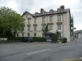
The Corbett Arms in Tywyn has fallen into serious disrepair.
Old Sarum fire in listed (& disputed) WW1 Hangar - Wiltshire Council has sought legal advice after fire engulfed a listed First World War hangar that was embroiled in a lengthy planning dispute.
UK Antarctic Heritage Trust launches ‘Virtual Visit’ website area

The Trust calls on people to 'Immerse yourself in our heritage – Making Antarctica Accessible'
Southend Council pledge to force Kursaal owners to maintain building
The Council has pledged to use ‘every tool in the toolbox’ if urgent repairs are not carried out.
HE’s Research Magazine publishes a major study of the heritage of England’s suburbs
The article traces the long evolution of an internal programme to research 200 years of suburban growth
IHBC Context 183 Wellbeing and Heritage published
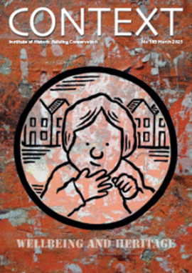
The issue explores issues at the intersection of heritage and wellbeing.
SAVE celebrates 50 years of campaigning 1975-2025

SAVE Britain’s Heritage has announced events across the country to celebrate bringing new life to remarkable buildings.
IHBC Annual School 2025 - Shrewsbury 12-14 June

Themed Heritage in Context – Value: Plan: Change, join in-person or online.
200th Anniversary Celebration of the Modern Railway Planned

The Stockton & Darlington Railway opened on September 27, 1825.
Competence Framework Launched for Sustainability in the Built Environment

The Construction Industry Council (CIC) and the Edge have jointly published the framework.